NZ Topo50 – Overview
This app is based on a simple concept: Bundle up the beautiful 1:50k topographic map crafted by Land Information New Zealand and combine it with a comprehensive and intuitive app to make it a versatile outdoor navigation tool.
Key features:
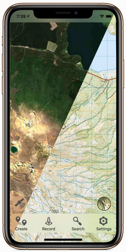
- Fully offline access to the entire map. No signups, no subscriptions, no need to pre-download or cache maps, no waiting for downloads from slow servers, just seamless offline pan and zoom across the whole country. The entire map is included when you install from your App Store.
- Designed for functionality. Our guiding design principle is for the app to be used. This means leaving out anything that isn’t needed for you to use the app, and building in as many things as we can that are useful. We are also happy to receive design ideas or feature requests and we’ll accommodate them where possible.
- True NZ grid. Built from the ground up using the NZ map datum (NZGD2000). This gives less distortion compared to the global average WGS84 datum commonly used.
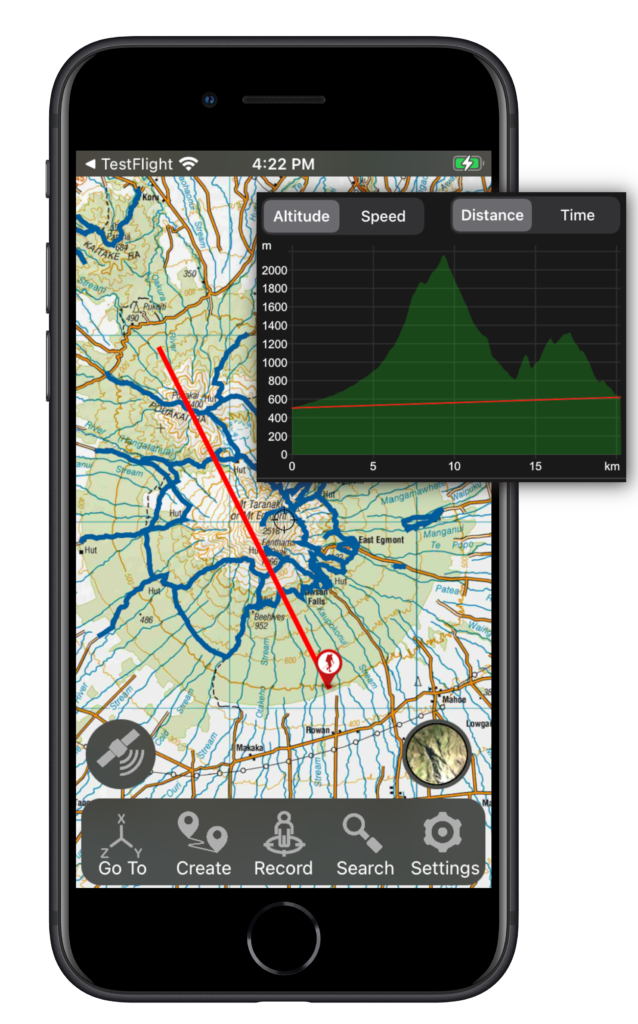
- Comprehensive navigational functions. GPS tracking, route planning, navigate to waypoints, compass bearings and triangulation. Searchable database of marked places.
- Additional data overlays. Includes aerial imagery, DOC hunting permit boundaries, huts, campgrounds, and tracks. Other tracks and data features can be imported.
Map Details
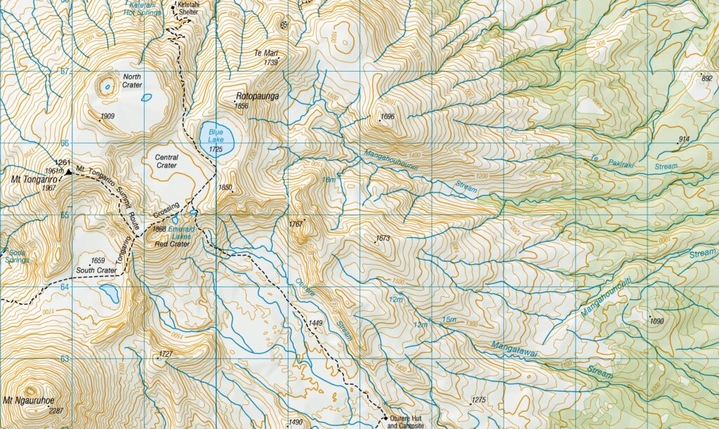
The map images used in the app are based on the 1:50k series maps (NZTopo50) produced by Land Information New Zealand (LINZ). This is the highest resolution topographic map officially produced by NZ. Height contours are on 20 m intervals. LINZ continually update the map and will be incorporated in the NZTopo50 app in periodic updates. At lower zoom levels LINZ NZTopo250 (1:250k) topographic map images are used.
Aerial images from LINZ Basemaps are also included, at a resolution matching the 1:50k topographic map, along with other data including DOC huts, campgrounds, tracks, and hunting permit boundaries.
The total data set is about 2GB for each Island.
Navigation Details
No cellphone coverage is required for any features of the app. Everything works fully offline from the moment the app is installed, including viewing all the maps to full 1:50k resolution and mapping and tracking your GPS position.
Navigation features include:
- Display your current GPS position on the map, along with data on altitude, speed, orientation, and map coordinates.
- Record your position over time. Display your track data, export and share your tracks.
- Import or create your own waypoints and routes.
- Navigate to waypoints or follow tracks.
Get in touch with us for any other design features you would like to see incorporated. We appreciate your input.
About Us
The NZTopo50 Apps are produced by Right Place Resources, proudly made in NZ. You might even see us out and about on various tracks, trails, or rivers around the country.